Drone Services
Crash Scene Investigations
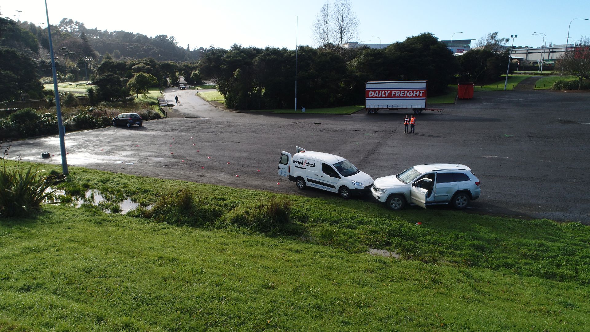
Crash scene rapid response
Transport Specifications Limited’s mobile service can rapidly respond to the site of the accident reducing the risk of evidence loss or contamination.
Non-invasive
Unlike traditional surveying methods we are able to document the entire site without risking scene contamination or shifting of vital evidence.
An aerial view can also be invaluable to obtain an overall perspective of the scene and identify otherwise hidden evidence.
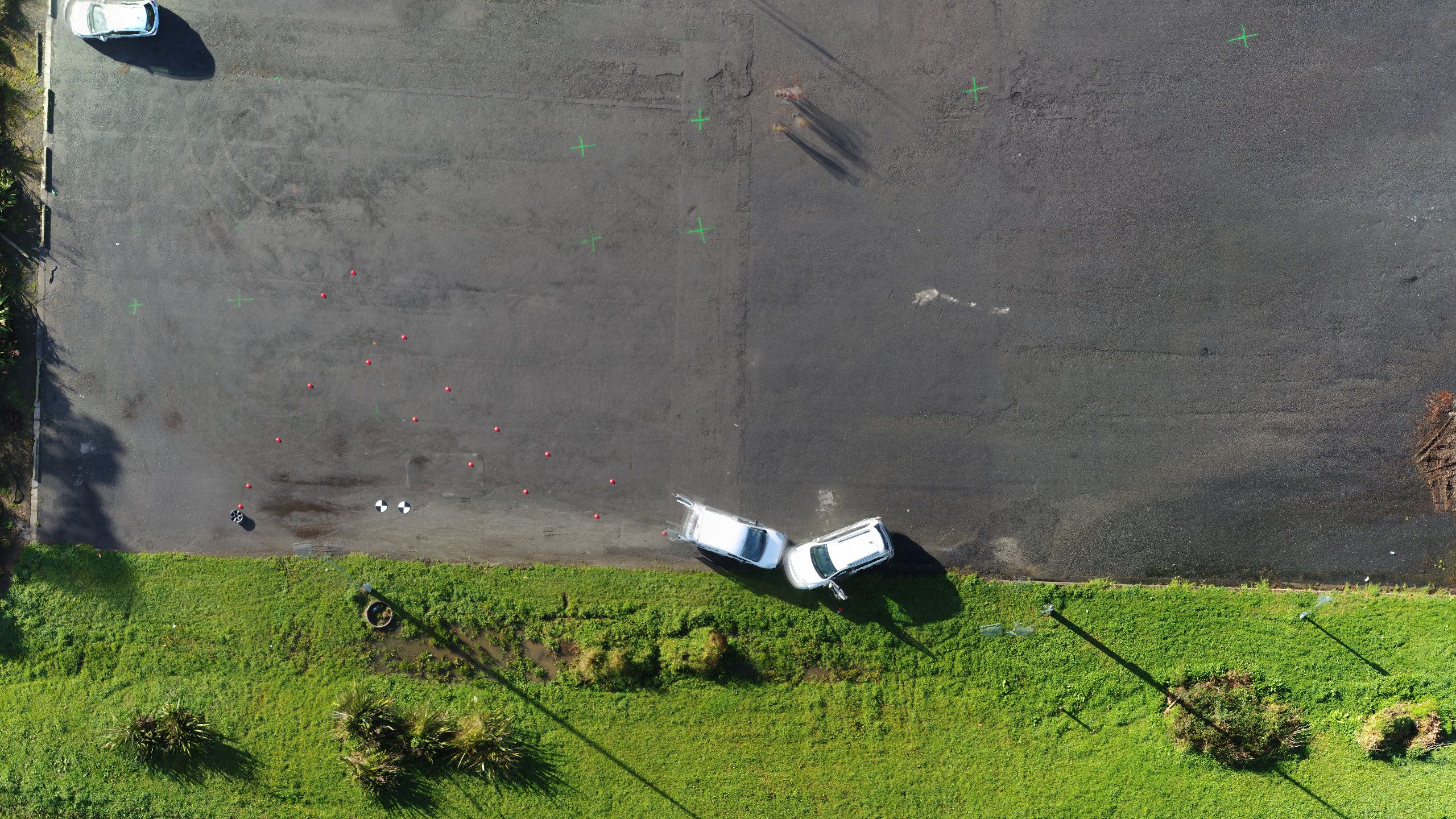
Accurate and measurable surveying
All documentation is accurate and to scale for later analysis and evaluation.
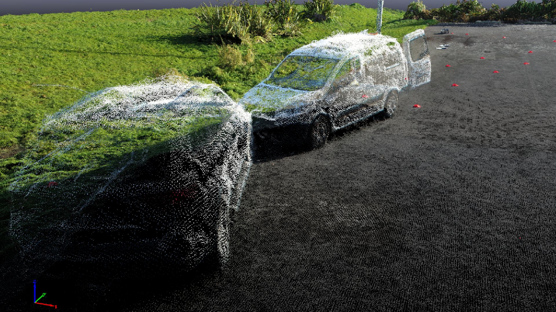
Full 3D reconstruction of accident scene
Transport Specifications are able to generate an accurate 3D reconstruction of the accident scene ideal for presentation.
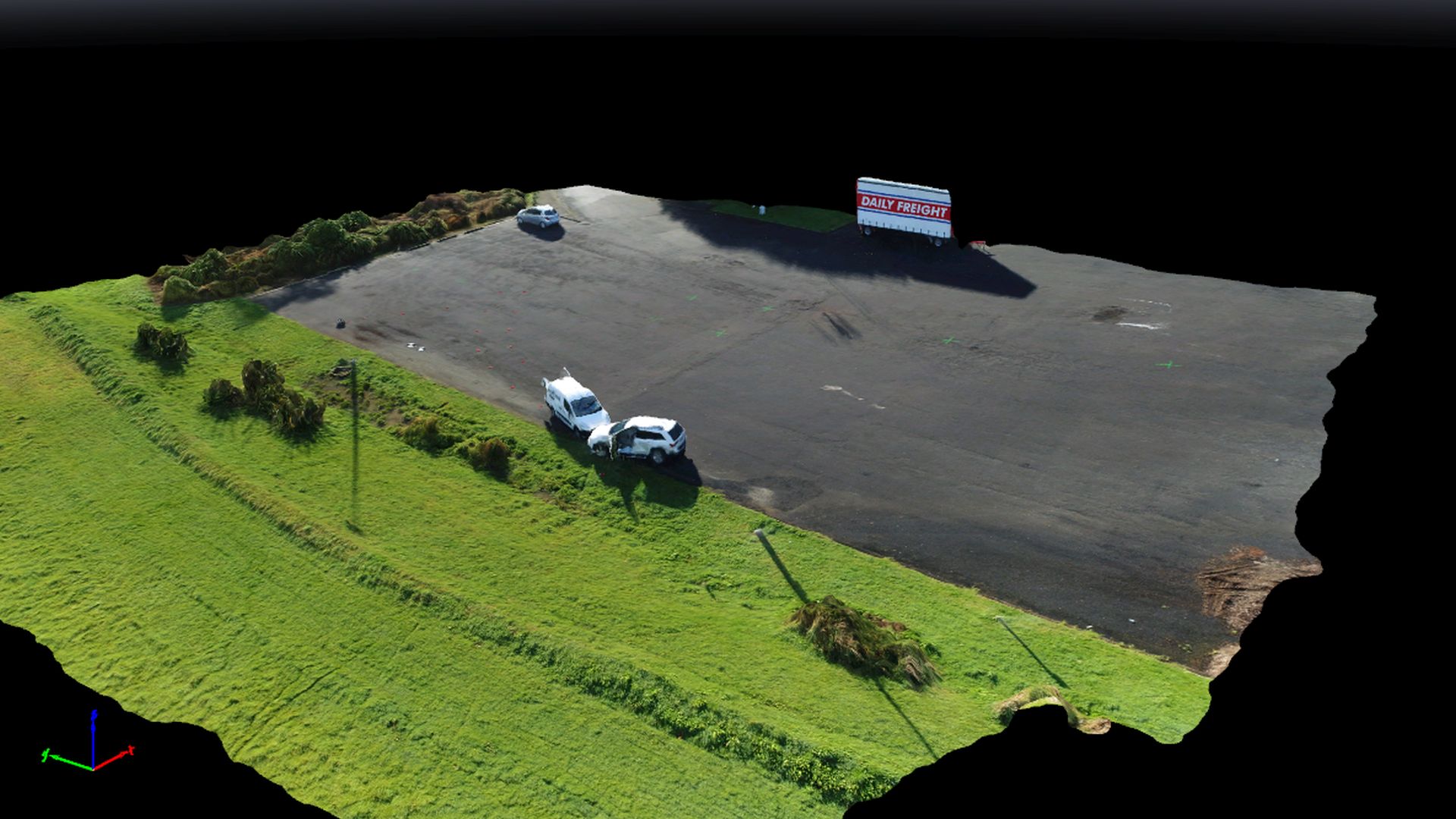
Physical and rendered fly-throughs of the accident scene
Swept Path Analysis for your vehicles
Satellite images cannot always be trusted to be up to date and accurate for a swept path analysis.
We can use our drone to survey the area and generate up to date and accurate aerial imagery to ensure your vehicle will come out unscathed.
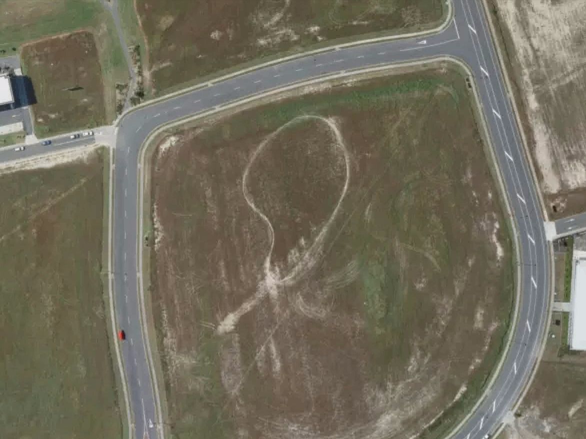
Satellite imagery available may be inaccurate and outdated.
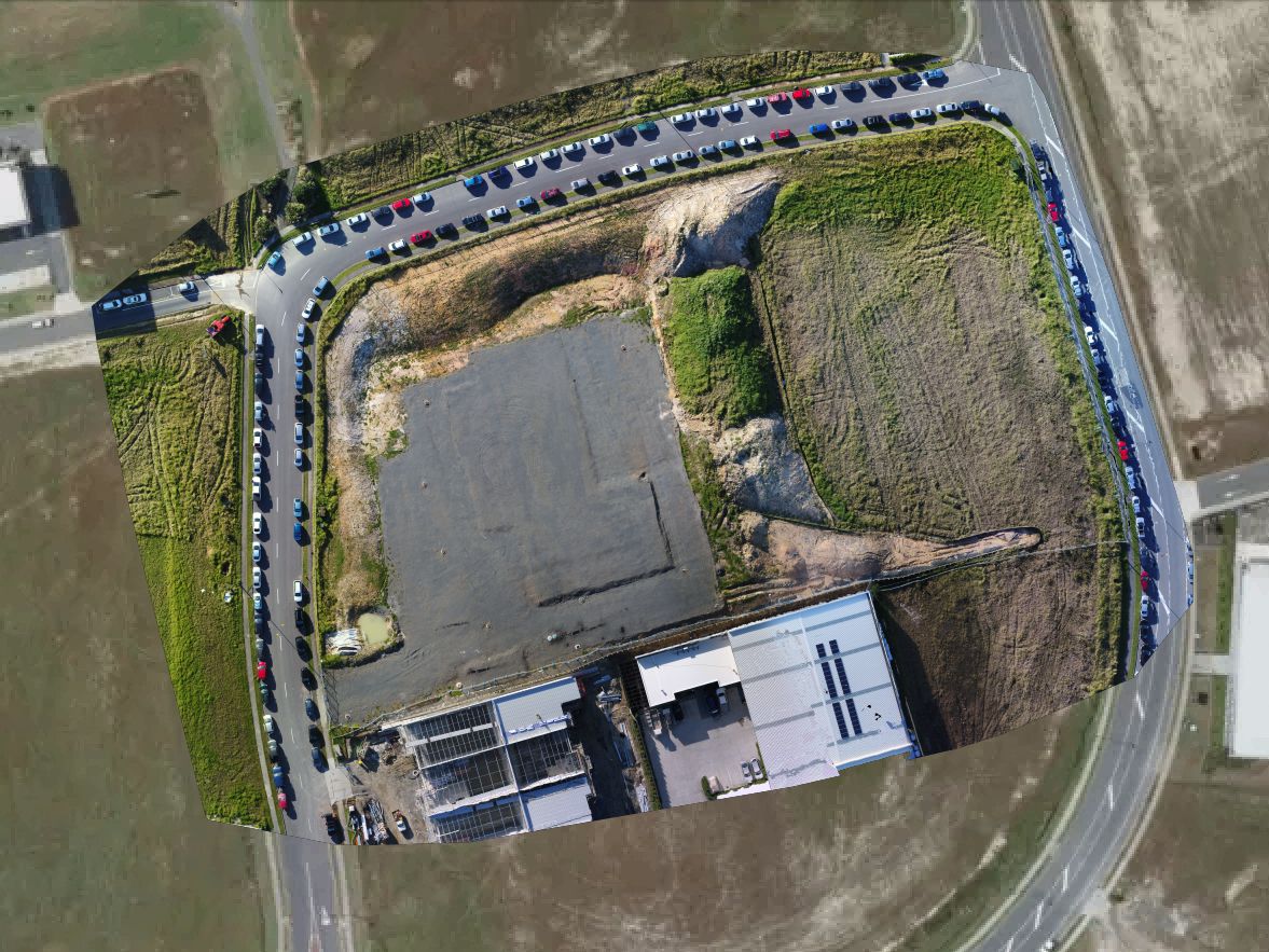
With our drone technology we can combine existing satellite imagery with high-resolution and up-to-date aerial imagery to provide accurate analysis for your vehicle.
Transport Specifications Limited can also conduct a swept path analysis on your vehicles through our AutoCAD based software or through physical testing, see our Swept Path page for further information.
Structural Surveying
Our drone can reach those inaccessible or dangerous to reach areas and provide high resolution images or video for analysis.
Structures such as bridges, roofs, pylons, towers and more can all be quickly and cost effectively surveyed without putting staff at risk.
Surveying of overpass bridge scaffold collapse
Following the structural collapse of scaffolding under a overpass bridge Transport Specifications Limited utilised a number of resources for surveying and documenting the incident site.
Videos and photos captured by the drone allowed rapid access to difficult angles without putting any staff or members of the public at risk.
Lift Plans for the Crane Industry
Have a tricky lift coming up?
Contact us to survey the site to provide a clear and accurate site-plan allowing you to coordinate the lift safely and more efficiently.
We can provide high resolution photos, videos, orthomosaics and even a full 3D model of the site if required.
CAA Part 102 Certification
Transport Specifications is a Civil Aviation Authority (CAA) Part 102 accredited drone operator.
This accreditation allows privileges to operate above 400ft AGL, at night and within 4km of an aerodrome.
